
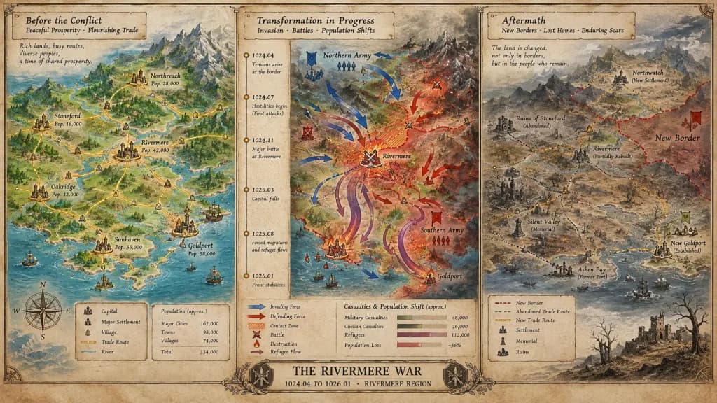
Tarihsel Kriz Kartografya Panosu
Barıştan çatışmaya ve sonrasına uzanan süreci belgeleyen üç bölümlü ayrıntılı bir kriz haritası oluşturun. Köşeli parantez içindeki olay, dönem ve bölgeyi özelleştirin.
İstem
A cartographer's crisis board mapping [CONFLICT] — [ERA / REGION], split horizontally into three distinct narrative panels across a single wide canvas. Left section: the situation before, featuring peaceful topography, trade routes traced in gold leaf, settlements marked with period-appropriate symbols, and annotated population figures. Center section: the transformation in progress, showing directional movement arrows, contact zones rendered in graduated intensity, a vertical timeline with key dates as waypoints, and casualties or population shifts visualized as proportional flow lines. Right section: the aftermath terrain, displaying altered borders, abandoned trade paths, newly established settlements, memorial markers, and a landscape bearing visible scars. The visual aesthetic transitions seamlessly from pastoral survey calmness to urgent wartime tactical graphics, ending in a melancholic documentary tone. Includes hand-lettered cartographic annotations throughout and an official title block reading "[EVENT NAME] — [START DATE] TO [END DATE], [GEOGRAPHIC SCOPE]".
Neleri özelleştirebilirsiniz
Oluşturmadan önce istemin bu kısımlarını kendi konunuz veya metninizle değiştirin.
[CONFLICT]yer tutucu[ERA / REGION]yer tutucu[EVENT NAME]yer tutucu[START DATE]yer tutucu[END DATE]yer tutucu[GEOGRAPHIC SCOPE]yer tutucu“[EVENT NAME] — [START DATE] TO [END DATE], [GEOGRAPHIC SCOPE]”tırnak içindeki metin
İstem ayrıntıları
- Kategori
- İnfografik / Eğitim
- Model
- Nano Banana Pro
- Görsel başına maliyet
- 1K: 108 kredi · 2K: 108 kredi · 4K: 193 kredi
- En boy oranı
- 16:9
- Eklenme