
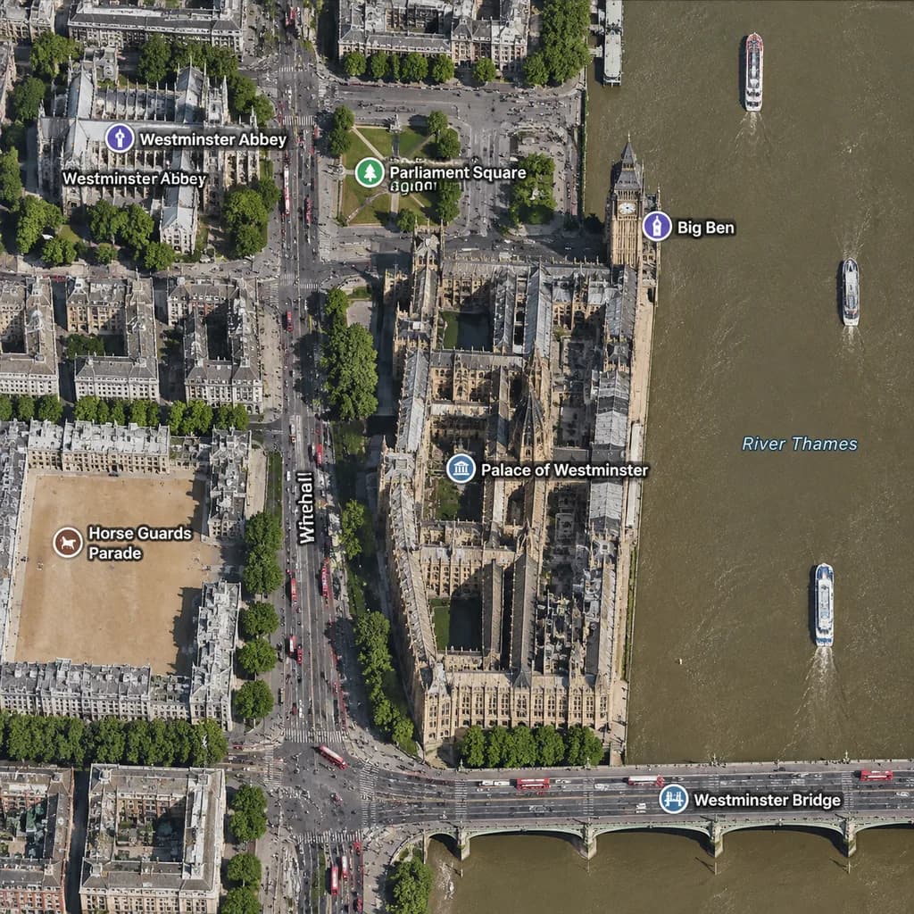
แผนที่ดาวเทียมเวสต์มินสเตอร์ ลอนดอน
สร้างมุมมองแผนที่ดาวเทียมแนวตั้งของย่านเวสต์มินสเตอร์พร้อมป้ายกำกับแผนที่ สามารถปรับแต่งชื่อเมือง แลนด์มาร์ก และสะพานสำหรับสถานที่ใดก็ได้
พรอมป์
A realistic top-down satellite map view of central [London], focused closely on the area around [Big Ben] and the Palace of Westminster beside the River Thames. Orthographic aerial perspective reminiscent of a modern digital mapping service or satellite photography layer, featuring detailed building rooftops, roads, trees with cast shadows, and natural brownish river water. The Palace of Westminster complex is oriented vertically near the center-right along the river's western bank, with [Big Ben] at its northeast corner near the water. A bridge labeled "[Westminster Bridge]" spans horizontally across the river near the bottom edge. Includes crisp digital map label overlays: "[Westminster Abbey]", "[Parliament Square]", "Big Ben", "Palace of Westminster", "[Westminster Bridge]", and "Horse Guards Parade", plus "Whitehall" labeled along the vertical road on the left. The layout features [Westminster Abbey] in the upper-left, [Parliament Square] above the palace, Horse Guards Parade as a sandy parade ground in the lower-left, dense urban blocks on the left half, and the River Thames with embankments and small boats on the right.
ส่วนที่ปรับแต่งได้
ก่อนสร้างภาพ ให้แทนที่ส่วนเหล่านี้ของพรอมป์ด้วยหัวข้อหรือข้อความของคุณเอง
[London]ตัวแทนข้อความ[Big Ben]ตัวแทนข้อความ[Westminster Bridge]ตัวแทนข้อความ[Westminster Abbey]ตัวแทนข้อความ[Parliament Square]ตัวแทนข้อความ“Big Ben”ข้อความในเครื่องหมายคำพูด“Palace of Westminster”ข้อความในเครื่องหมายคำพูด“Horse Guards Parade”ข้อความในเครื่องหมายคำพูด
รายละเอียดพรอมป์
- หมวดหมู่
- อินโฟกราฟิก / การศึกษา
- โมเดล
- GPT IMAGE 2
- ค่าใช้จ่ายต่อภาพ
- 1K: 43 เครดิต · 2K: 86 เครดิต · 4K: 143 เครดิต
- อัตราส่วนภาพ
- 1:1
- วันที่เพิ่ม