
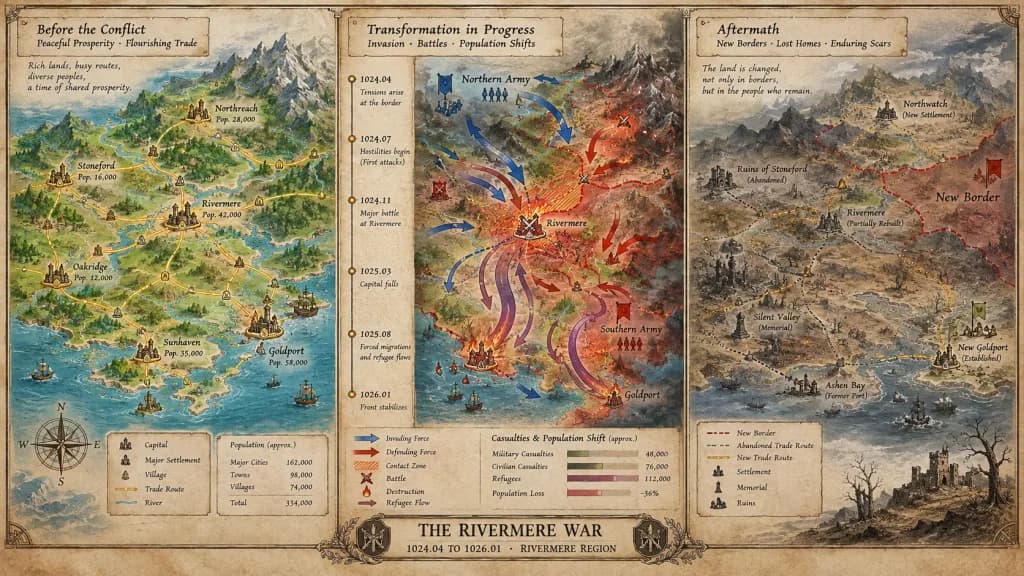
แผนที่กระดานวิกฤตประวัติศาสตร์
สร้างแผนที่กระดานวิกฤตสามส่วนที่แสดงการเปลี่ยนแปลงจากความสงบสู่ความขัดแย้งและผลกระทบ ปรับแต่งชื่อเหตุการณ์ ยุคสมัย และภูมิภาคในวงเล็บ
พรอมป์
A cartographer's crisis board mapping [CONFLICT] — [ERA / REGION], split horizontally into three distinct narrative panels across a single wide canvas. Left section: the situation before, featuring peaceful topography, trade routes traced in gold leaf, settlements marked with period-appropriate symbols, and annotated population figures. Center section: the transformation in progress, showing directional movement arrows, contact zones rendered in graduated intensity, a vertical timeline with key dates as waypoints, and casualties or population shifts visualized as proportional flow lines. Right section: the aftermath terrain, displaying altered borders, abandoned trade paths, newly established settlements, memorial markers, and a landscape bearing visible scars. The visual aesthetic transitions seamlessly from pastoral survey calmness to urgent wartime tactical graphics, ending in a melancholic documentary tone. Includes hand-lettered cartographic annotations throughout and an official title block reading "[EVENT NAME] — [START DATE] TO [END DATE], [GEOGRAPHIC SCOPE]".
ส่วนที่ปรับแต่งได้
ก่อนสร้างภาพ ให้แทนที่ส่วนเหล่านี้ของพรอมป์ด้วยหัวข้อหรือข้อความของคุณเอง
[CONFLICT]ตัวแทนข้อความ[ERA / REGION]ตัวแทนข้อความ[EVENT NAME]ตัวแทนข้อความ[START DATE]ตัวแทนข้อความ[END DATE]ตัวแทนข้อความ[GEOGRAPHIC SCOPE]ตัวแทนข้อความ“[EVENT NAME] — [START DATE] TO [END DATE], [GEOGRAPHIC SCOPE]”ข้อความในเครื่องหมายคำพูด
รายละเอียดพรอมป์
- หมวดหมู่
- อินโฟกราฟิก / การศึกษา
- โมเดล
- Nano Banana Pro
- ค่าใช้จ่ายต่อภาพ
- 1K: 108 เครดิต · 2K: 108 เครดิต · 4K: 193 เครดิต
- อัตราส่วนภาพ
- 16:9
- วันที่เพิ่ม