
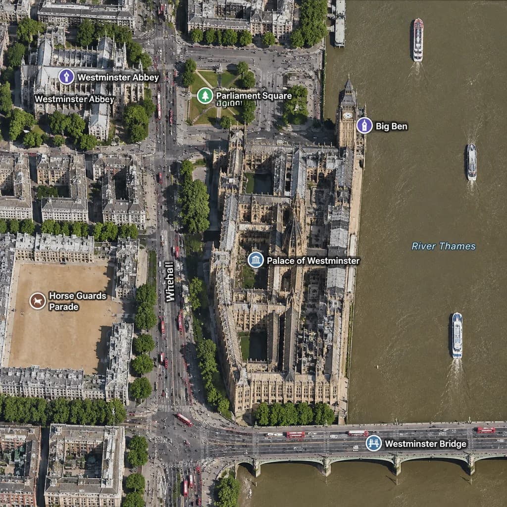
Mapa satelitarna Westminsteru w Londynie
Generuje ortograficzny widok satelitarny Westminsteru z etykietami kartograficznymi. Zmień miasto, zabytki i mosty, aby zmapować dowolne miejsce.
Prompt
A realistic top-down satellite map view of central [London], focused closely on the area around [Big Ben] and the Palace of Westminster beside the River Thames. Orthographic aerial perspective reminiscent of a modern digital mapping service or satellite photography layer, featuring detailed building rooftops, roads, trees with cast shadows, and natural brownish river water. The Palace of Westminster complex is oriented vertically near the center-right along the river's western bank, with [Big Ben] at its northeast corner near the water. A bridge labeled "[Westminster Bridge]" spans horizontally across the river near the bottom edge. Includes crisp digital map label overlays: "[Westminster Abbey]", "[Parliament Square]", "Big Ben", "Palace of Westminster", "[Westminster Bridge]", and "Horse Guards Parade", plus "Whitehall" labeled along the vertical road on the left. The layout features [Westminster Abbey] in the upper-left, [Parliament Square] above the palace, Horse Guards Parade as a sandy parade ground in the lower-left, dense urban blocks on the left half, and the River Thames with embankments and small boats on the right.
Co możesz dostosować
Przed generowaniem zamień te części promptu na własny temat lub tekst.
[London]symbol zastępczy[Big Ben]symbol zastępczy[Westminster Bridge]symbol zastępczy[Westminster Abbey]symbol zastępczy[Parliament Square]symbol zastępczy“Big Ben”tekst w cudzysłowie“Palace of Westminster”tekst w cudzysłowie“Horse Guards Parade”tekst w cudzysłowie
Szczegóły promptu
- Kategoria
- Infografika / Edukacja
- Model
- GPT IMAGE 2
- Koszt za obraz
- 1K: 43 kredytów · 2K: 86 kredytów · 4K: 143 kredytów
- Proporcje
- 1:1
- Dodano