
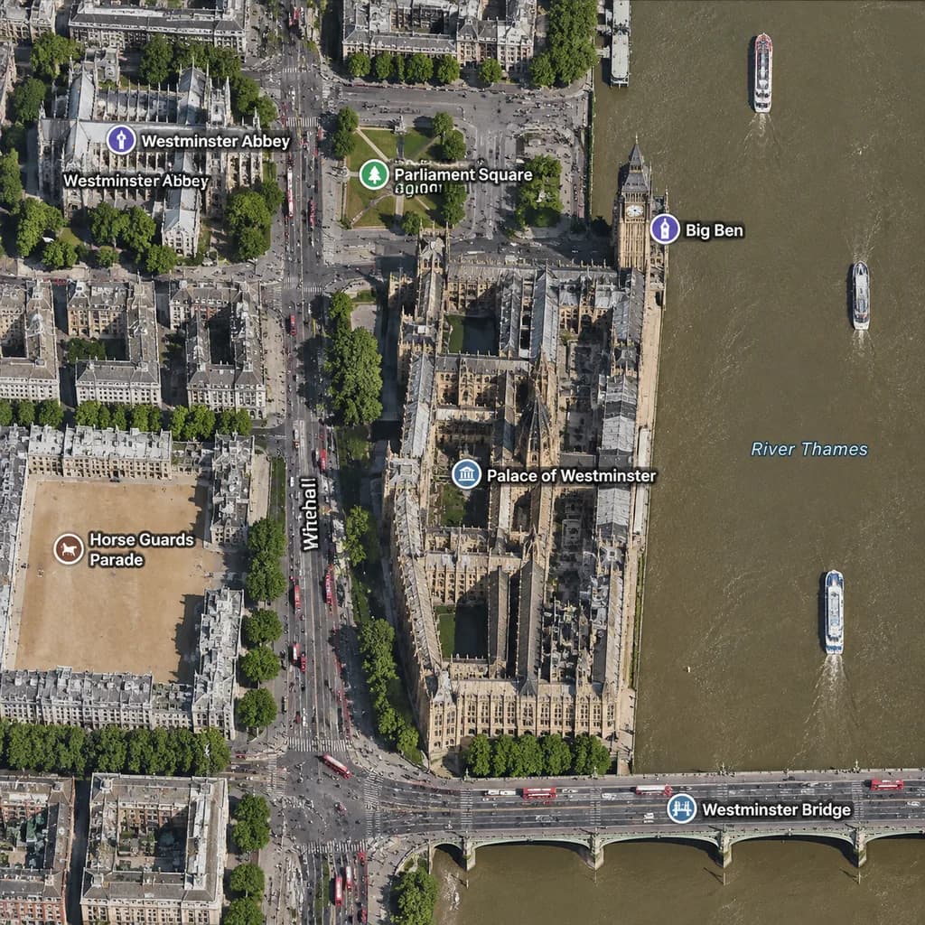
런던 웨스트민스터 위성 지도
지도 라벨이 포함된 웨스트민스터 지역의 직교 위성 지도를 생성합니다. 도시, 랜드마크, 다리 및 거리 이름을 변경하여 맞춤 설정할 수 있습니다.
프롬프트
A realistic top-down satellite map view of central [London], focused closely on the area around [Big Ben] and the Palace of Westminster beside the River Thames. Orthographic aerial perspective reminiscent of a modern digital mapping service or satellite photography layer, featuring detailed building rooftops, roads, trees with cast shadows, and natural brownish river water. The Palace of Westminster complex is oriented vertically near the center-right along the river's western bank, with [Big Ben] at its northeast corner near the water. A bridge labeled "[Westminster Bridge]" spans horizontally across the river near the bottom edge. Includes crisp digital map label overlays: "[Westminster Abbey]", "[Parliament Square]", "Big Ben", "Palace of Westminster", "[Westminster Bridge]", and "Horse Guards Parade", plus "Whitehall" labeled along the vertical road on the left. The layout features [Westminster Abbey] in the upper-left, [Parliament Square] above the palace, Horse Guards Parade as a sandy parade ground in the lower-left, dense urban blocks on the left half, and the River Thames with embankments and small boats on the right.
바꿔 쓸 수 있는 부분
생성하기 전에 프롬프트의 이 부분을 원하는 주제나 문구로 바꿔 보세요.
[London]자리 표시자[Big Ben]자리 표시자[Westminster Bridge]자리 표시자[Westminster Abbey]자리 표시자[Parliament Square]자리 표시자“Big Ben”따옴표 안 문구“Palace of Westminster”따옴표 안 문구“Horse Guards Parade”따옴표 안 문구
프롬프트 정보
- 카테고리
- 인포그래픽 / 교육
- 모델
- GPT IMAGE 2
- 이미지당 비용
- 1K: 43 크레딧 · 2K: 86 크레딧 · 4K: 143 크레딧
- 화면 비율
- 1:1
- 추가일