
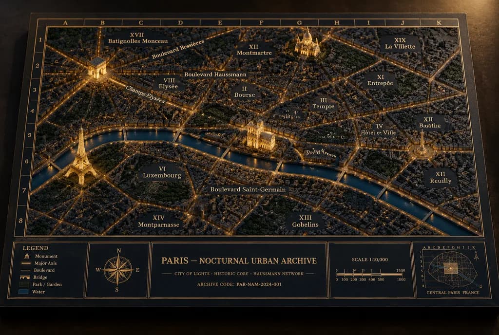
야간 도시 건축 디오라마 아카이브 지도
입체 랜드마크와 박물관 아카이브 스타일의 파리 야경 디오라마 지도를 생성합니다. 도시, 랜드마크, 텍스트 라벨을 자유롭게 변경할 수 있습니다.
프롬프트
A museum-quality physical diorama architectural archive map board titled "[PARIS — NOCTURNAL URBAN ARCHIVE]", showing [Paris] at night as an archival relief model with illuminated streets, raised sculptural landmarks, and cartographic borders. Setting & Canvas: Landscape 3:2 perspective view of a thick rectangular archival matte board resting on a dark matte tabletop. Angled slightly from above, front-facing, showing tactile board thickness and soft cast shadows. Color palette is dark navy, charcoal, and antique-gold with restrained warm amber illumination. Layout & Cartography: The city map fills most of the board, enclosed in a double-line gold border with an alphanumeric coordinate grid (letters A–K across the top, numbers 1–8 down the side). At the bottom, a structured information band is split into five distinct panels: 1) a legend panel, 2) a compass rose panel, 3) a large centered title/archive panel, 4) a scale bar panel, and 5) a locator-map panel. Map Details: Dense low-relief 3D urban model made of miniature matte plaster or resin buildings and engraved street blocks. A dark satin-navy river cuts horizontally through the lower-center with subtle reflections. Major boulevards, avenues, and bridges glow with fine amber light lines. Parks appear as darker textured green-black patches. Raised Landmarks: Exactly four prominent illuminated miniature 3D landmarks: 1) Eiffel Tower in the lower-left near the river, glowing gold; 2) Arc de Triomphe in the upper-left with radiating avenues; 3) Notre-Dame Cathedral on the central island; 4) Sacré-Cœur on the upper-right hill. All landmarks are finely sculpted, matte, and warmly illuminated. Annotations & Typography: Fine serif gold lettering directly on the map surface. Exactly 14 district labels: XVII Batignolles Monceau, VIII Élysée, IX Opéra, XIII Montmartre, XIX La Villette, X Entrepôt, II Bourse, III Temple, IV Hôtel de Ville, XI Bastille, XII Reuilly, XIII Gobelins, VI Luxembourg, XIV Montparnasse. Major route labels: Champs-Élysées, Boulevard Haussmann, Boulevard Saint-Germain, Boulevard Bessières. Bottom Information Band: - Center title panel: "[PARIS — NOCTURNAL URBAN ARCHIVE]", subtitle "[CITY OF LIGHTS · HISTORIC CORE · HAUSSMANN NETWORK]", and "[ARCHIVE CODE: PAR-NAM-2024-001]". - Legend panel: 5 symbolized items: Monument, Major Axis, Boulevard, Bridge, Park / Garden, Water. - Scale panel: "SCALE 1:10,000" with a segmented bar marked 0, 100, 200, 300, 400, 500, 1000 M. - Locator panel: small coordinate grid and miniature outline map labeled "CENTRAL PARIS FRANCE". Style: Hyper-realistic macro photograph of an architectural archive model, tactile paper grain, gold foil stamping, pinprick LED warmth, crisp central focal plane, soft subtle vignette. Constraints: No modern UI, no neon, no people, no glossy plastic, no digital overlays.
바꿔 쓸 수 있는 부분
생성하기 전에 프롬프트의 이 부분을 원하는 주제나 문구로 바꿔 보세요.
[PARIS — NOCTURNAL URBAN ARCHIVE]자리 표시자[Paris]자리 표시자[CITY OF LIGHTS · HISTORIC CORE · HAUSSMANN NETWORK]자리 표시자“[ARCHIVE CODE: PAR-NAM-2024-001]”따옴표 안 문구“SCALE 1:10,000”따옴표 안 문구“CENTRAL PARIS FRANCE”따옴표 안 문구
프롬프트 정보
- 카테고리
- 인포그래픽 / 교육
- 모델
- GPT IMAGE 2
- 이미지당 비용
- 1K: 43 크레딧 · 2K: 86 크레딧 · 4K: 143 크레딧
- 화면 비율
- 3:2
- 추가일