
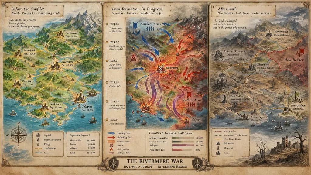
지도 제작자의 역사적 위기 보드 맵
평화에서 갈등, 그리고 그 여파에 이르기까지 시간의 흐름을 보여주는 3단계 위기 보드 지도를 생성합니다. 대괄호 안의 사건명, 시대 및 지역을 변경해 맞춤 설정하세요.
프롬프트
A cartographer's crisis board mapping [CONFLICT] — [ERA / REGION], split horizontally into three distinct narrative panels across a single wide canvas. Left section: the situation before, featuring peaceful topography, trade routes traced in gold leaf, settlements marked with period-appropriate symbols, and annotated population figures. Center section: the transformation in progress, showing directional movement arrows, contact zones rendered in graduated intensity, a vertical timeline with key dates as waypoints, and casualties or population shifts visualized as proportional flow lines. Right section: the aftermath terrain, displaying altered borders, abandoned trade paths, newly established settlements, memorial markers, and a landscape bearing visible scars. The visual aesthetic transitions seamlessly from pastoral survey calmness to urgent wartime tactical graphics, ending in a melancholic documentary tone. Includes hand-lettered cartographic annotations throughout and an official title block reading "[EVENT NAME] — [START DATE] TO [END DATE], [GEOGRAPHIC SCOPE]".
바꿔 쓸 수 있는 부분
생성하기 전에 프롬프트의 이 부분을 원하는 주제나 문구로 바꿔 보세요.
[CONFLICT]자리 표시자[ERA / REGION]자리 표시자[EVENT NAME]자리 표시자[START DATE]자리 표시자[END DATE]자리 표시자[GEOGRAPHIC SCOPE]자리 표시자“[EVENT NAME] — [START DATE] TO [END DATE], [GEOGRAPHIC SCOPE]”따옴표 안 문구
프롬프트 정보
- 카테고리
- 인포그래픽 / 교육
- 모델
- Nano Banana Pro
- 이미지당 비용
- 1K: 108 크레딧 · 2K: 108 크레딧 · 4K: 193 크레딧
- 화면 비율
- 16:9
- 추가일