
Infografik / Edukasi
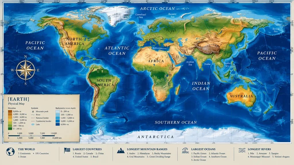
Peta Fisik Dunia dengan Panel Informasi
Menghasilkan peta fisik dunia yang detail lengkap dengan batimetri, kompas, dan panel data bawah. Sesuaikan palet warna atau judul peta.
peta duniakartografitopografibatimetriinfografisgeografi
Jelajahi prompt serupaPrompt AI Infografis
Prompt
{
  "type": "highly detailed cartographic world map",
  "style": "[realistic topographical and bathymetric colors]",
  "map_features": {
    "terrain": "shaded relief depicting mountains, valleys, and plains in natural greens, browns, and whites",
    "oceans": "bathymetric depth gradients in blue tones, lighter over continental shelves and dark navy in oceanic trenches",
    "grid": "precise latitude and longitude graticule across the global projection",
    "labels": "major continents, nations, oceans, and seas clearly labeled with elegant serif and sans-serif typography"
  },
  "layout": {
    "overlays": [
      {
        "type": "compass rose",
        "position": "mid-left, over the Pacific Ocean",
        "description": "ornate 8-point nautical compass"
      },
      {
        "type": "legend",
        "position": "bottom left",
        "title": "[EARTH]",
        "subtitle": "[Physical Map]",
        "contents": "elevation color ramp, cartographic symbols, and metric distance scale"
      }
    ],
    "bottom_panels": {
      "count": 5,
      "position": "horizontal row along the bottom border",
      "labels": [
        "THE WORLD",
        "LARGEST COUNTRIES",
        "LONGEST MOUNTAIN RANGES",
        "LARGEST OCEANS",
        "LONGEST RIVERS"
      ]
    }
  }
}Yang bisa Anda ubah
Sebelum membuat gambar, ganti bagian prompt ini dengan subjek atau teks Anda sendiri.
[realistic topographical and bathymetric colors]placeholder[EARTH]placeholder[Physical Map]placeholder
Detail prompt
- Kategori
- Infografik / Edukasi
- Model
- GPT IMAGE 2
- Biaya per gambar
- 1K: 43 kredit · 2K: 86 kredit · 4K: 143 kredit
- Rasio aspek
- 16:9
- Ditambahkan