
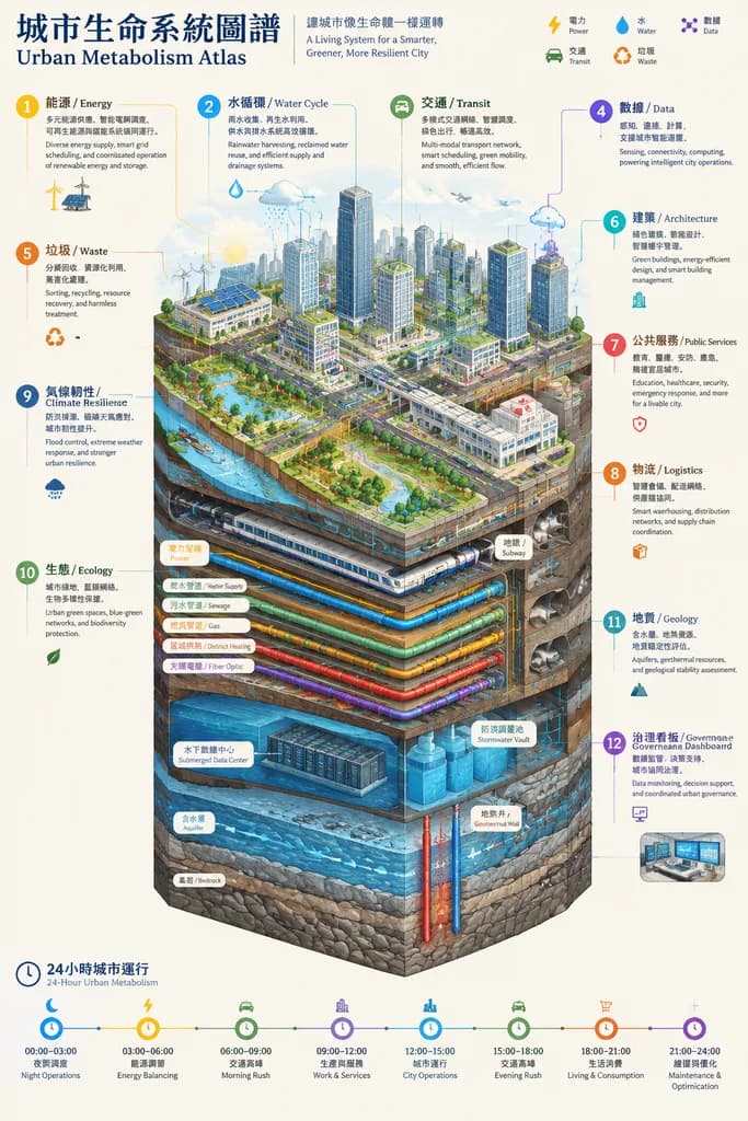
مخطط معلومات مقطعي لأيض المدينة الذكية
أنشئ أطلس مقطعي متساوي القياس يوضح تفاصيل البنية التحتية الحضرية من ناطحات السحاب حتى الصخر السفلي. يمكنك تعديل التصنيفات والألوان لتخصيص الرسم.
المطالبة
Vertical isometric cutaway infographic poster titled "城市生命系统图谱 / Urban Metabolism Atlas", illustrating a comprehensive smart city cross-section from open sky to deep bedrock. Above ground features skyscrapers, streets, and green spaces; underground layers reveal subway networks, utility tunnels, water, sewage, gas, and district heating pipelines, fiber optic cables, submerged data centers, stormwater flood retention vaults, natural aquifers, geothermal wells, and geological bedrock strata. Clear color-coded circulatory flows represent power, water, digital data, vehicle traffic, and waste management. Includes 12 numbered bilingual (CN/EN) callout panels: 能源/Energy, 水循环/Water Cycle, 交通/Transit, 数据/Data, 垃圾/Waste, 建筑/Architecture, 公共服务/Public Services, 物流/Logistics, 气候韧性/Climate Resilience, 生态/Ecology, 地质/Geology, and 治理看板/Governance Dashboard. A continuous 24-hour timeline diagram runs along the bottom. Style of a high-end engineering white paper and scientific atlas, clean off-white paper background, razor-sharp technical linework, clear data visualization, no cyberpunk tropes.
ما يمكنك تخصيصه
قبل الإنشاء، استبدل هذه الأجزاء من المطالبة بموضوعك أو نصك الخاص.
“城市生命系统图谱 / Urban Metabolism Atlas”نص بين علامتي تنصيص
تفاصيل المطالبة
- النموذج
- GPT IMAGE 2
- التكلفة لكل صورة
- 1K: 43 رصيد · 2K: 86 رصيد · 4K: 143 رصيد
- نسبة العرض إلى الارتفاع
- 9:16
- المنشئ
- 小红书号insight_express
- الترخيص
- MIT
- تاريخ الإضافة