
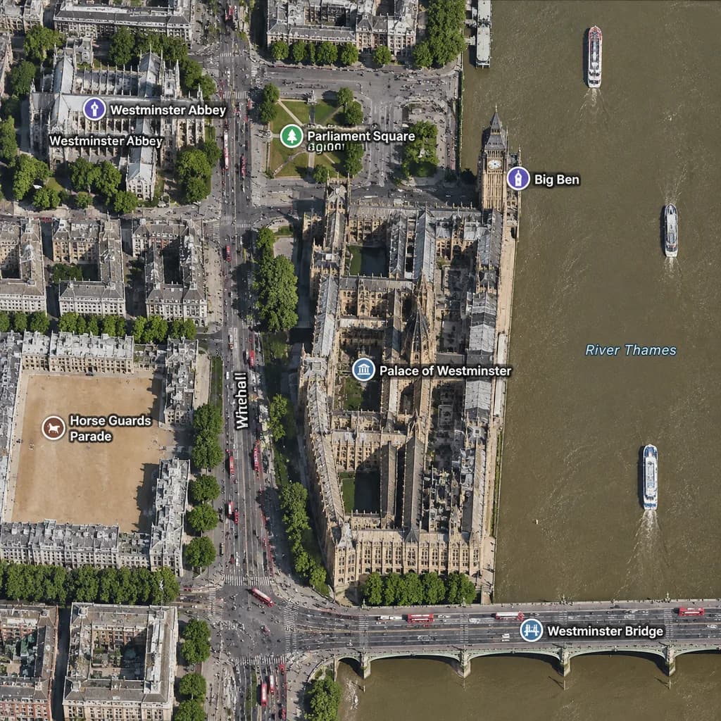
خريطة أقمار صناعية لوستمنستر في لندن
أنشئ خريطة أقمار صناعية متعامدة لمنطقة وستمنستر مع تسميات جغرافية واضحة. يمكنك تعديل المدينة والمعالم والجسور لتمثيل أي موقع تريده.
المطالبة
A realistic top-down satellite map view of central [London], focused closely on the area around [Big Ben] and the Palace of Westminster beside the River Thames. Orthographic aerial perspective reminiscent of a modern digital mapping service or satellite photography layer, featuring detailed building rooftops, roads, trees with cast shadows, and natural brownish river water. The Palace of Westminster complex is oriented vertically near the center-right along the river's western bank, with [Big Ben] at its northeast corner near the water. A bridge labeled "[Westminster Bridge]" spans horizontally across the river near the bottom edge. Includes crisp digital map label overlays: "[Westminster Abbey]", "[Parliament Square]", "Big Ben", "Palace of Westminster", "[Westminster Bridge]", and "Horse Guards Parade", plus "Whitehall" labeled along the vertical road on the left. The layout features [Westminster Abbey] in the upper-left, [Parliament Square] above the palace, Horse Guards Parade as a sandy parade ground in the lower-left, dense urban blocks on the left half, and the River Thames with embankments and small boats on the right.
ما يمكنك تخصيصه
قبل الإنشاء، استبدل هذه الأجزاء من المطالبة بموضوعك أو نصك الخاص.
[London]عنصر نائب[Big Ben]عنصر نائب[Westminster Bridge]عنصر نائب[Westminster Abbey]عنصر نائب[Parliament Square]عنصر نائب“Big Ben”نص بين علامتي تنصيص“Palace of Westminster”نص بين علامتي تنصيص“Horse Guards Parade”نص بين علامتي تنصيص
تفاصيل المطالبة
- النموذج
- GPT IMAGE 2
- التكلفة لكل صورة
- 1K: 43 رصيد · 2K: 86 رصيد · 4K: 143 رصيد
- نسبة العرض إلى الارتفاع
- 1:1
- تاريخ الإضافة